
QTH locator calculator based on the Maidenhead method.
The display of the locator and coordinates in every part of the world.
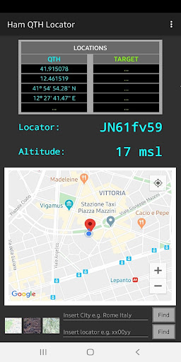
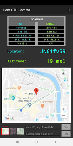
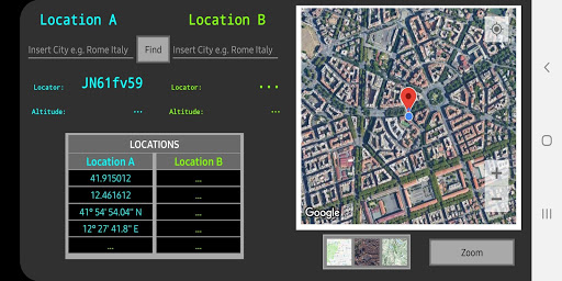
Calculation of distances, orientation and altitude.You can view the locator determined by the GPS position, then the longitude and latitude expressed in decimals and degrees, the altitude above sea level (blue color).It is possible to display all the same information relating to the new position (green color).
You can also see the distance and orientation in degrees.Touching the marker you will get the information of the point on the map.You can view the different types of maps (Map, Satellite, Terrain).If you wish, you can enter the tracker (eg Aa00bbnn or aa00bb) in the box below, you will see the position on the map.You can also enter the name of the place of interest (eg city name, address or place name, etc.) and you will still see it displayed on the map.As soon as you open the screen you will see your GPS position displayed on the map.You can enter the name of the locations that interest you, then see all the relevant information displayed.Touching the marker you will get the information of the point on the map.You can view the different types of maps (Map, Satellite, Terrain) with the possibility of "Zoom".
https://andro.io/app/wwlocator
 Power 100

Android app profile
Ham QTH Locator Pro for Android – Latest Version & Features
by IdeaNew2015
★★★★★
(0 ratings)
Rate this app
How do you feel about Ham QTH Locator Pro?
Thanks for your feedback!
> 2.2k
Monthly Downloads
~$900
Estimated Cost
Screenshots


