
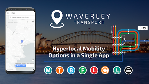
Waverley Transport app is great as a route planner including private and public transport.
With a tap on your phone you can - Get directions, city maps, timing, train & bus timetable, check fares, save favourite stops & get real-time information for all transit types.
The app provides you the efficient and affordable ways to commute and travel across Sydney & NSW.Waverley Transport is your mobility partner to guide & plan your journey with all transport modes:-
🚍 bus
🚆 train
🚇 metro
🚋 tram
⛴ ferry
🚕 ride services
🚗 wheelchair accessible taxi
🚙 car share
🚴 bicycle and
🚶walkingFind the closest stop, and easily check which ride is next there!FEATURES OF WAVERLEY TRANSPORT:
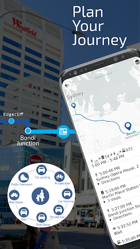
✔️ Detailed directions across combinations of transport modes (public & private).
Find the best combinations of trips to your destination.
✔️ Provides safe and continuous routes for trams, wheelchairs, and children on bicycles
✔️ Step-by-step directions, details of street-by-street turns, stop-by-stop timings, wait timings etc.
✔️ Encourages the use of designated safe pick-up/drop-off (PUDO) zones
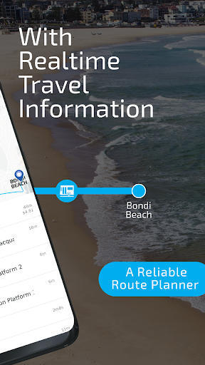
✔️ Reliable route planner - Know Train & Bus timetable to check out which ride is next there!
✔️ Trip planner with city maps, fare estimates, vehicle operating costs, tolls, etc.
✔️ Save bus stops and train stations.
✔️ EV charging locations to plan longer transit trips
🔌
⚡
💡
✔️ Personalize your trips by picking your route preferences.ONE APP FOR ALL TRANSPORT MODES FOR SYDNEY NSW TO REACH NEXT THERE STOP:Public transport includes trains, metro trains, buses, ferries, and light rail trams.
Private transport includes rental cars, ride services, car share, cab, taxi, wheelchair taxi, walking, cycling etc.
🚉 Major Sydney NSW trains interchanges:
🚉
⚬ Central Station
⚬ Chatswood Station
⚬ Circular Quay Station
⚬ North Sydney Station
⚬ Parramatta Station
⚬ Town Hall Station
⚬ Bondi Junction Station
🚏 Major bus stops:
🚏
⚬ Bondi Beach
⚬ Westfield Bondi Junction
⚬ Maroubra
⚬ Parramatta
⚬ Randwick
⚬ Sydney CBD
⚬ Surry Hills
👉
👉 Some more interesting features given below are coming soon in your trip planner app for Sydney NSW
👈
👈
📱 LIVE Maps & Notifications during your trip↗️ Turn-by-turn Navigation
📥 Save Favorite Destinations& many more..So, why wait!
Let’s make your trip easy.
➡️
➡️
➡️ Download Waverley Transport App and route planner and check train & bus timetable, as well as other private and public transport options and city maps.
Keep in touch
❤️ If you have questions or any feedback for us, email us at [email protected] with the best.
Ride the Waverley!
https://andro.io/app/timetable-10u6u
 Power 100

Android app profile
Waverley Transport: Maps, Time for Android – Latest Version & Features
by Smart Cities Transport, Sydney NSW, Route Planners
★★★★★
(0 ratings)
Rate this app
How do you feel about Waverley Transport: Maps, Time?
Thanks for your feedback!
> 2.2k
Monthly Downloads
~$900
Estimated Cost
Screenshots


