
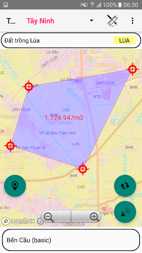
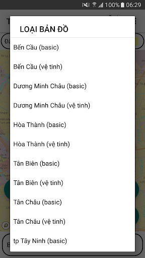
- Support to look up the land use planning of the districts.- Ben Cau, Duong Minh Chau, Hoa Thanh, Tan Bien, Tan Chau, Tay Ninh city, Trang Bang, Go Dau.- Using Mapbox.coms basemap technology on published land use plans- Determine the users current location on the land use planning map- Use 02 coordinate systems Longitude, Latitude and coordinate system VN2000- Support map zoom function, rotate Map in North-South axis- Find and save the coordinates of the current position- Electronic compass (only supports devices with magnetic induction chip)- Support for customizing transfer calculation parameters- Save and Display points, areas by Object, Project- Change color, hide and show objects and points in the Project- Save the free drawn area- View, Edit, Delete, Find Landmarks- Function to navigate to objects, save points- Support the function to redraw survey route over time- Support function to display map styles from mapbox.com- Draw Points, Polygon Domains; Measure Distance, calculate Area- Export point data into .kml .gpx .
file types- Support import point data from .gpx .
file- Send and exchange data of save points- Supports conversion tools between coordinate systems
https://andro.io/app/tayninh-10z2l
 Power 100

Android app profile
QH sử dụng đất Tây Ninh for Android – Latest Version & Features
by Trần Cường
★★★★★
(0 ratings)
Rate this app
How do you feel about QH sử dụng đất Tây Ninh?
Thanks for your feedback!
> 2.2k
Monthly Downloads
~$900
Estimated Cost
Screenshots