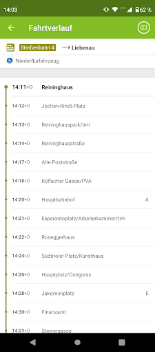
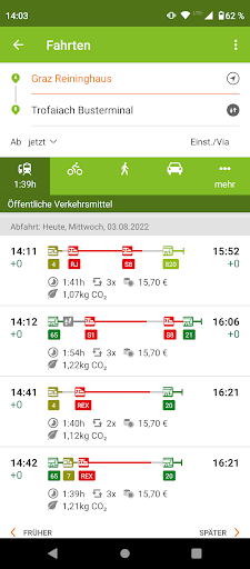
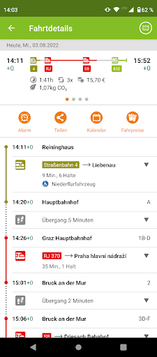
With the BusBahnBim App you will always find the best route in all of Austria: whether by public transport, on foot, by bike or by car. Based on the Traffic Information Austria (VAO), the multimodal app is working multimodally – you can also combine with functions like Bike & Ride, Park & Ride and Car Train.BusBahnBim works simply by address input and always uses the most up-to-date data. For example, the current traffic situation can also be included, including construction sites, congestion, delays, diversions, etc. Also stop-call names are no longer necessary for the query, by activating the GPS-positioning, the current location can be used as the starting point. Optionally, the desired destination address, a street name or point of interest can be used.The BusBahnBim App allows quick, uncomplicated information, a realistic comparison of the time involvement of different modalities, clear maps and charts to the orientation offer and fascinate with a modern design. A favorite choice, dispatch of the connection and info via e-mail or SMS, storage of the departure times and arrival times in the calendar are other useful features.Overview of the functions of the BusBahnBim App:· Stop search via GPS· Journey proposals incl. time involvement· Connecting dispatch via e-mail or SMS· Memory possibility with reminiscent function in the calendar· Clear map representation by high-resolution map· Define your own favorites· Intermodal comparison between public transportation, foot / bicycle routes and motocar routes and the time involvement· Monitor announcement for an elective stopDescription of permissions:· Camera:Allows the user to take a photo for a personal take-me-there favorite in the trip planner.· Contacts:Enables that the usage of contacts/addresses from the users phone book for searching (e.g. input of start or destination in the trip planner or searching via map view).· Location:Network-based locating or locating via GPS enables routing to or from the current position. · Have full network access:Is necessary for internet access of the app.· Install shortcuts:Enables the user so save shortcuts on the home screen of the device. · View network connections:Allows the app to check the status of the internet connection (access yes/no, type of connection (wifi, mobile data etc.)).