
The SmartPTSL application is an application that helps accelerate the work of Systematic Complete Land Registration (PTSL).
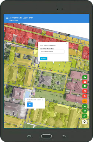
The SmartPTSL application is a Mobile GIS (Geographic Information System) based application that runs on android media with features that have been adapted to the needs of PTSL.
The SmatPTSL application is not a measurement tool but a medium for pouring measurement figures from meet bands, aerial photography interpretations and connections to external GNSS.The features in the Smart PTSL application are as follows: 1.
Distance Correction Results of Satellite Image Delineation / Photo Map of UAV / Drone 2.
Integration of physical and juridical data 3.
Supporting Data Input a.Base Map (UAV / Drone and CSRT) Spatial data of land parcels in the form of Shapefile (* Shp) as a working map c.
Textual data of parcels of land (Subject, object, Mastery, Ownership, Relationship Law, Field Entry 201 and Statement of Physical Mastery. d.External GNSS 4.
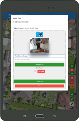
Geotagging Photos of Subjects and Objects 5.
Export Data a.Export Measuring Figure and Map of Measurement results Export data measurement results in the form of Shapefile (* SHP) c.
Export the list of names of measurement results (excel file)
https://andro.io/app/smartgis
 Power 100
Android app profile
Smart PTSL for Android – Latest Version & Features
★★★★★
(0 ratings)
Rate this app
How do you feel about Smart PTSL?
Thanks for your feedback!
> 2.2k
Monthly Downloads
~$900
Estimated Cost
Screenshots