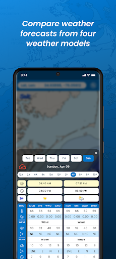
SALTWEATHERSaltWeather is the ONLY marine forecast app that provides four of the most accurate weather forecast models SIDE-BY-SIDE.
This allows you to compare the models to see if they are projecting similar weather.
If the models are forecasting similar conditions, you can feel more confident that the forecast should be accurate, greatly increasing your go/no-go decisions for boating ventures.
WEATHER FORECASTWeather forecasts are provided by four of the most accurate weather models available and are viewed side-by-side.
Forecasts are available by the hour out to 6 days and provide information on sunrise/sunset, weather forecasts including air temperature, precipitation, wind speed and direction, wave height, direction and period.OCEAN CONDITIONSOcean Conditions are provided by the GFS model and provide forecasts out to 6 days.
Information provided include daily high and low tides, hourly tide height change, moon phase, phytoplankton density, chlorophyll-a concentration, and sea surface temperature.
WEATHER MODELSThanks to SaltWeather, subscribers are able to view, SIDE-BY-SIDE, hourly forecasts from four of the most accurate weather models.
Models used in SaltWeather are ICON (German Weather Centre), GFS (NOAA), WWO (World Weather Center), and EURO (European Weather Centre).PROPRIETARY BASEMAPThe developers at SaltWeather have created a custom basemap that gives everything you need without all of the clutters included in the NOAA navigation map.
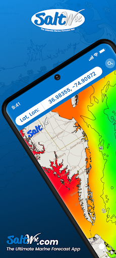
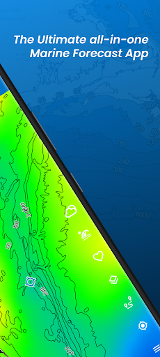
Our basemap provides ocean contours depths categorized by color making it easier to view depth changes.
Our map is then topped off with detailed contours lines showing the depths.
We made it easy to find the 20 and 30 fathom lines!
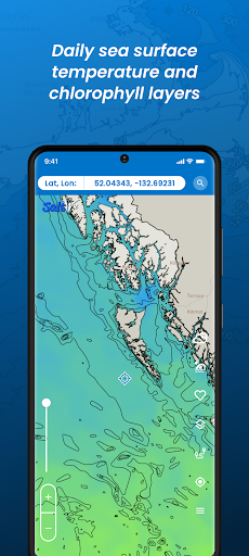
SATELLITE OVERLAYSOur satellite overlay data are obtained from Copernicus Ocean Data Centre and updated daily.
The three overlays available are: • Sea Surface Temperature• Chlorophyll-a Concentration• Ocean CurrentsFREE TRIP PLANNING TOOLSSaltWeather also provides free tools to help with your boating and sailing ventures.
Tools provided include Favorite Waypoints, Distance measuring and GPS coordinate Converter.
LIST OF PREMIUM WEATHER PARAMETERS- PAID CONTENTOur premium subscription provides a tremendous amount of valuable information to aid in your offshore trips.
Forecast parameters in the subscription include:
✅Hourly weather and ocean condition forecasts out to 6 days
✅Tides
✅Phytoplankton
✅Moon phase
✅Chlorophyll- concentrations
✅Sea surface temperatures
✅Air temperature
✅Precipitation
✅Wind forecasts
✅Wave forecasts
✅ Satellite overlaysDo you have questions or suggestions?Follow us on social media• Facebook: https://www.facebook.com/SaltWeather• Instagram: https://www.instagram.com/saltwx/• YouTube: https://www.youtube.com/@saltweather4793Visit our website on: https://www.saltwx.comWe welcome feedback on our product.
Submit questions or comments to our customer service team at: [email protected]
https://andro.io/app/salt-wx
 Power 100
Android app profile
SaltWeather for Android – Latest Version & Features
★★★★★
(0 ratings)
Rate this app
How do you feel about SaltWeather?
Thanks for your feedback!
> 2.2k
Monthly Downloads
~$900
Estimated Cost
Screenshots