
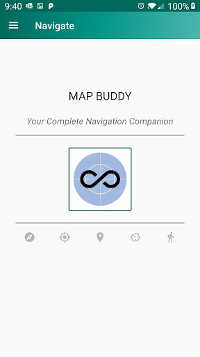
Ranger is an All-in-One mapping and tracking application.
It has multiple activities for all navigation and outdoor pursuits.
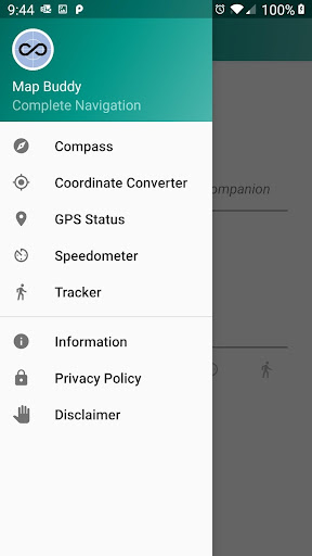
** EVERYTHING YOU NEED IS IN ONE PLACE **Activities included are:COMPASS: A stable compass that points to True North or Magnetic North.GEOCONVERTER: Accurate conversion of Latitude/Longitude to:- degrees, minutes, seconds - decimal degrees- Military Grid Reference System (MGRS) - United States National Grid (USNG) - Universal Transverse Mercator (UTM)- International Mapcode- Google Pluscode- Maidenhead Locator- British National Grid- Irish Transverse MercatorGPS STATUS: Check the GPS on your device.
All Global Navigation Satellite Systems (GNSS) are included, such as:- Navstar (GPS)- Galileo- Glonass- Beidou- QZSS- Satellite Based Augmentation Systems (SBAS).SPEEDOMETER: Shows speed in multiple units and also provides location, altitude and course over the ground - it also works in flight-safe mode, so you can try it out on aircraft.TRACKER: Store and share a track.
Very handy for saving an off road hike or bike trail - you can share the files to view later on your favorite mapping software.TRACKER RETRACE: You can retrace your stored track - if you like to go hiking off-trail - you need never get lost again.Usage instructions are given in the "About" section for all of the included activities, and there are Settings for each activity.
https://andro.io/app/rangerdg
 Power 100


Android app profile
Ranger for Android – Latest Version & Features
by DriveGenics
★★★★★
(0 ratings)
Rate this app
How do you feel about Ranger?
Thanks for your feedback!
> 2.2k
Monthly Downloads
~$900
Estimated Cost
Screenshots


