
Nautical Charts — OsmAnd is an extension for OsmAnd Maps & Navigation app that provides free nautical charts for offline use.
This sea map will be your reliable companion whether you are going fishing or planning a sea travel.Nautical Charts are a detailed graphical representation of oceans, seas, coastal areas, and rivers.
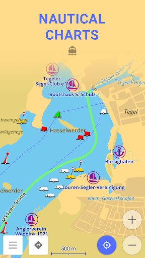
The charts can contain various information like sailing routes, navigation lights, dangerous areas, areas where its allowed or not allowed to sail or dock, etc.
These maps are also supplemented with the information about the depth contours and nautical depth points that add valuable layers of data to the map.All the professional sailors are obliged to have official marine charts on their ships.
These charts are published by authorized agencies and cost quite some money.
Agencies are investing a lot in keeping the charts up to date.
They release updates for the charts on a regular basis, but because of the fact that reviewing the information and processing the updates takes quite some time, the nautical charts are never completely up-to-date.Nautical charts by OsmAnd are based on the data from the OpenSeaMap project.
The idea of the project is to build the detailed map by people who actually use it.
Every user of the map can contribute by adding changes to it making it more detailed and more accurate.While OpenSeaMap charts at the moment cannot compete with official nautical charts, they can be used by recreational sailors for orientation or route planning.
This plugin does not provide nautical navigation but it is your offline reference tool that can be used together with other navigational programs.Usage Instructions: it is highly recommended to download nautical basemap in order to see the maps regardless of detailed map presence.
Nautical charts are provided as a map and a special style, to switch style in OsmAnd please use the menu item Configure Map on the map screen.
https://andro.io/app/nauticalplugin
 Power 100
Android app profile
Nautical Charts — OsmAnd for Android – Latest Version & Features
by OsmAnd
★★★★★
(0 ratings)
Rate this app
How do you feel about Nautical Charts — OsmAnd?
Thanks for your feedback!
> 2.2k
Monthly Downloads
~$900
Estimated Cost
Screenshots


