
Visualized METAR and TAF weather information for all airports in the world.
Concise summary of everything you need to know about todays aviation weather.
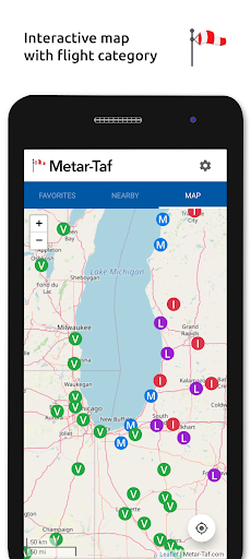
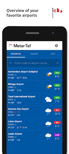
METAR features: - Visualized in easy to understand and colourful metrics- Weather symbols for significant weather and clouds, like in a non-aviation weather report- Crosswind calculations, by combining METAR and runway information- Flight rules category: VFR, MVFR, IFR, LIFR- Read out by text-to-speech available, listen to a decoded METAR while doing other thingsTAF features:- TAF broken down and displayed per hour in a table- Show sunrise/sunset, minimum and maximum temperatureKeeping track:- Add your favorite stations to the list, see their weather at a glance- Get observations near your location- Find stations in the interactive map with weather codes- Search airports by ICAO code or nameHistory:- Graphs with weather trends today and yesterday: temperature, visibility, wind speed, QNH- METAR history for the last hours and link to more on the websiteAirport information:- See information about the airports, like runway directions, elevation, location - If the airport doesnt report a METAR, the nearest station used for calculationsCalculations:- All units are customizable units: speed (knots, km/h, m/s, mph), altitude (meters/feet), visibility (kilometers/miles), temperature (Celcius/Fahrenheit) and air pressure (Hectopascal, Inch Hg)- Times are converted to the local time for each airport- Sunrise and sunset are calculated based on the airports latitude/longitudeGeneral:- METAR, TAF and airport data are automatically saved for offline use- Available in 6 languages: English, Dutch, Spanish, Portuguese, German and French
https://andro.io/app/metar-taf
 Power 100


Android app profile
Metar-Taf - Visual decoder for Android – Latest Version & Features
★★★★★
(0 ratings)
Rate this app
How do you feel about Metar-Taf - Visual decoder?
Thanks for your feedback!
> 2.2k
Monthly Downloads
~$900
Estimated Cost
Screenshots