
The app turns your smartphone into a GPS bike computer with useful features!
Whether youre on your way to work, shopping or simply cycling for fun.
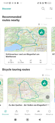
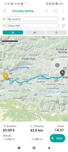
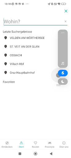
The app brings you reliably to your destination.APP FUNCTIONS:- An optimized navigation for cyclists- Easy selection or entry of addresses (starting point, destination point)- Start your tour by simply clicking on the desired destination on the map- Display of the last entered start and end points- Simply add start and finish points to favorites to make them easier and faster to find- Route: Determination of the recommended and shortest route- Display of the route on the map- Route: Display altitude profile, driving time, length, your arrival time and the remaining time and kilometers- Routing instructions with image and text while driving on the map- SPECIAL: Voice-guided navigation in German and English- If there is a route deviation, this will be recalculated immediately- Most accurate and up to date map and navigation base- stops and departure monitor (S-Bahn)- Display precipitation radarNo matter where you are traveling with your bike, you will be navigated as best you can to your destination.We endeavor to continuously develop and improve the Radlkarte app.We hope you enjoy cycling and are looking forward to your review.
https://andro.io/app/kaernten
 Power 100
Android app profile
radapp kärnten for Android – Latest Version & Features
by Verkehrsauskunft Österreich
★★★★★
(0 ratings)
Rate this app
How do you feel about radapp kärnten?
Thanks for your feedback!
> 2.2k
Monthly Downloads
~$900
Estimated Cost
Screenshots


