
GPS Monitor helps you to check navigation satellites explored by your device and location information they provide.
The application displays the objects of the following global navigation satellite systems (GNSS): GPS, GLONASS, Beidou, Galileo and other systems (QZSS, IRNSS).
In addition, you can get your current latitude, longitude, altitude, heading and speed data.
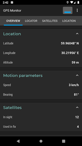
The application does not require an Internet connection, so you can determine the location even in airplane mode.The "Overview" tab contains basic information about the state of the navigation system: longitude, latitude, altitude, heading and speed of your device.
The tab shows the total amount of navigation satellites in the field of view and the number of satellites used for positioning.The "Locator" tab displays a map of visible navigation satellites.
Satellites whose data is used by the device are highlighted in blue.
Objects can be filtered by its type and state.The "Satellites" tab contains a list of objects whose signal is registered by the device.
Displayed parameters: type of navigation system (GNSS), identification number, azimuth, elevation, frequency, signal-to-noise ratio and others.
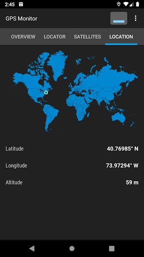
The list can be filtered and sorted by several parameters.The "Position" tab includes a world map with a label for the current position, current longitude and latitude coordinates, and altitude.
https://andro.io/app/gpsmonitoring
 Power 100


Android app profile
GPS Monitor: satellite data for Android – Latest Version & Features
★★★★★
(0 ratings)
Rate this app
How do you feel about GPS Monitor: satellite data?
Thanks for your feedback!
> 2.2k
Monthly Downloads
~$900
Estimated Cost
Screenshots


