
With the GIS SHedit app, authorized users can capture geodata of specific topics on the go and on-site.Welcome to the geographical information platform of the canton of Schaffhausen.
GIS SH is the abbreviation for "Geographical Information System Schaffhausen" and offers you two-dimensional views with georeferenced and interactive maps.Edit stands for editing, so that new geodata can be recorded and changed.In order to be able to record geodata for a specific topic, the user needs a user account which he can apply to the Office for Geoinformation.Hints:==========* The maps and geodata offered are limited to the Canton of Schaffhausen* Only geodata in the canton can be recorded* A mobile data connection is required to use the GIS SHedit app.
There may be feesFeatures:==========* Acquisition and processing of point, line and surface geometries, including information on them* Capture photos for each geometry directly in the app* Measure distance and area* Different background map views: orthophoto, open street map* Search for locations* GPS localization* Offline useThis app is based on Sabretooth from Kaden & Partner AG https://www.sabretooth.ch/
https://andro.io/app/gisshedit2
 Power 100


Android app profile
GIS SHedit for Android – Latest Version & Features
★★★★★
(0 ratings)
Rate this app
How do you feel about GIS SHedit?
Thanks for your feedback!
> 2.2k
Monthly Downloads
~$900
Estimated Cost
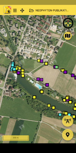
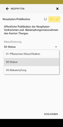
Screenshots


