
Provides operators with the latest survey plans, an interactive mine map, face mark-up abilities, and an operator toolbox to guide users through complex mark-ups.
Keep development headings on line, reduce re-work, overbreak and underbreak, and improve standards of work through best practice mark-up.
FEATURES:• Take the guess work out of the more difficult mark-ups such as laser offsets, angled drives and fillets.
The Operator Toolbox includes tutorials to take operators through step-by-step best practice methods for marking up complex drives.
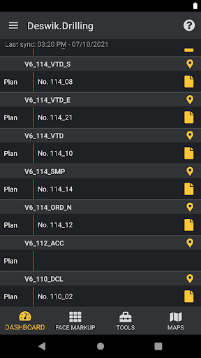
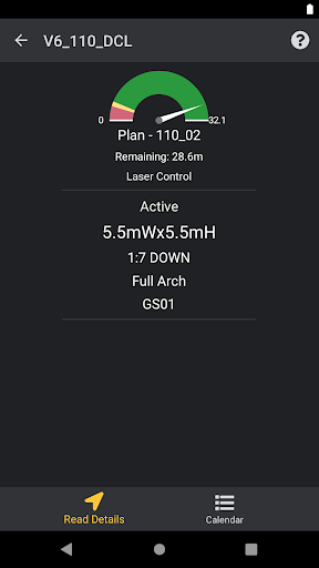
• A built-in offset calculator allows operators to enter in the face distance, the laser offsets and then be stepped through the process of marking up the face efficiently and accurately.• Save time and eliminate the need to chase survey plans on the surface by accessing all the current plans for headings within the easy-to-read Dashboard.
• An interactive mine map allows operators to see their work location, view the levels above and below, view survey station locations, and see the design and as-builts for each level.
• Take photos and record data on the job, removing the need to file paper face mark-up sheets.
https://andro.io/app/drilling
 Power 100

Android app profile
Deswik.Drilling for Android – Latest Version & Features
by Deswik
★★★★★
(0 ratings)
Rate this app
How do you feel about Deswik.Drilling?
Thanks for your feedback!
> 2.2k
Monthly Downloads
~$900
Estimated Cost
Screenshots


