CoordTransform is an Android tool for conversion between Geodetic systems (latitude & longitude as provided by GPS) and Universal Transverse Mercator (UTM) system.Supports 58 reference ellipsoids datums, but is not capable of transforming from one ellipsoid to another.
The default ellipsoid is WGS84 used by the GPS system.Supports 3 different latitude / longitude input formats: * Decimal degrees (DD.DDD)* Degrees /decimal minutes (DD MM.MMM) * Degrees / minutes and decimal seconds (DD MM SS.SSS).With this app, you can convert between UTM or Latitude / Longitude from your phone GPS.
Its a useful tool for map reading and navigation (land or sea navigation).
So is useful for outdoor sports like hiking, orienteering, bushwalking, mountain biking, kayaking, surveying, or anything where you need to read coordinates from a map and convert between formats.
Also useful in Search and Rescue (SAR) or GIS where conversion between different formats is needed.
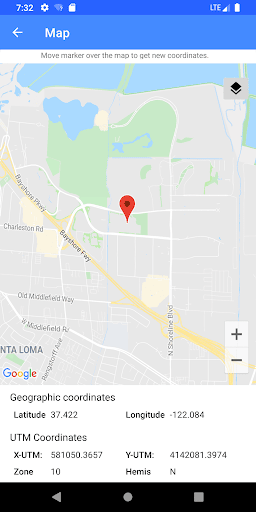
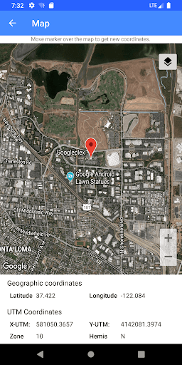
The coordinates can be entered manually or dynamically using a map in the app.
Drag and drop the marker around the map and data (both geographic and UTM) will be automatically updated.Coordinates can be copied to a clipboard with a long press or shared via SMS or e-mail.** If you want to make a suggestion or find a bug, e-mail me and I will fix it.**"
https://andro.io/app/coordtransform
 Power 100


Android app profile
CoordTransform for Android – Latest Version & Features
★★★★★
(0 ratings)
Rate this app
How do you feel about CoordTransform?
Thanks for your feedback!
> 2.2k
Monthly Downloads
~$900
Estimated Cost
Screenshots