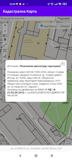
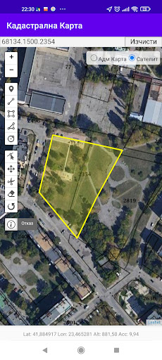
The "Cadastre BG" application is a civil initiative for convenient access to public cadastral information and enables users to find and outline property boundaries using the GPS receiver on their phone or tablet.IMPORTANT !!!
DUE TO THE LOW ACCURACY OF THE GPS DEVICES IN YOUR PHONE OR TABLET, THE MEASURED POSITION IS ONLY INDICATIVE WITH AN ACCURACY OF A FEW METERS AND SHOULD NOT BE USED FOR THE PRECISE DETERMINATION OF PROPERTY BOUNDARIES, TRACKING OR PROPERTY DISPUTES!- The in-app tools and map information should only be used for personal information and rough geographic orientation.
- The application is not an official state source of cartographic information and the information provided may be incomplete and inaccurate.- Users must agree to use the application aware of the risk of errors, inaccuracies or lack of service.- All official cadastral inquiries should be made in the "KAIS" portal of the Agency for Cartography, Geodesy and Cadastre at https://kais.cadastre.bg/* Cadastre BG application performs the role of a kind of web browser that only visualizes the cadastral maps delivered in real time at the request of the user from the public portal KAIS.
The application does not copy, store, process or modify cadastral maps and data.
The application does not store or share information about the geolocation of its users, as well as about the geoinformation data and maps received by them.
https://andro.io/app/cadastre-11hw5
 Power 100


Android app profile
Кадастър BG for Android – Latest Version & Features
by NandTech LTD
★★★★★
(0 ratings)
Rate this app
How do you feel about Кадастър BG?
Thanks for your feedback!
> 2.2k
Monthly Downloads
~$900
Estimated Cost
Screenshots