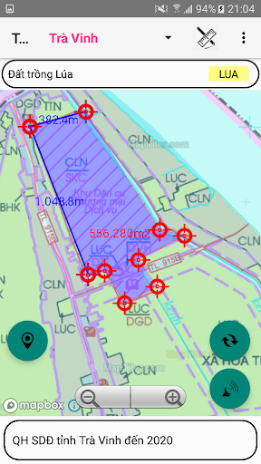
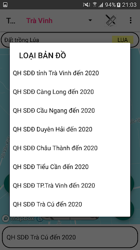
- Support to look up land use planning in Ben Tre province, districts of Cang Long, Cau Ngang, Duyen Hai, Chau Thanh, Tieu Can, Tra Vinh City, Tra Cu- Use Mapbox.com basemap technology on published land use plans- Determine the users current location on a land use planning map- Using 02 coordinate systems of Longitude, Latitude and coordinate system VN2000- Support map zoom function, rotate Map according to North-South axis- Find and mark current location by name- Electronic compass (supports only devices with magnetic sensors)- Support to customize the transfer calculation parameters- Save and Display points, areas, areas by Objects, Projects- Change colors, hide objects, points in the Project- Save the free of the drawn area- View, Edit, Delete, Find Landmarks- Function of navigation to objects, save points- Support to re-draw the survey route from time to time- Support function of displaying map styles from mapbox.com- Draw Points, Polygonal Domains; Measure Distance, Calculate Area- Export point data to .kml .gpx file types- Support importing point data from .gpx file- Send and exchange data of saved points- Supports converting tools between coordinate systems