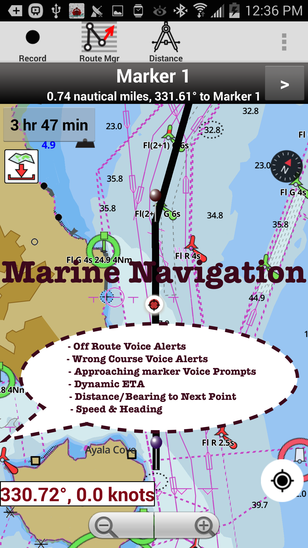
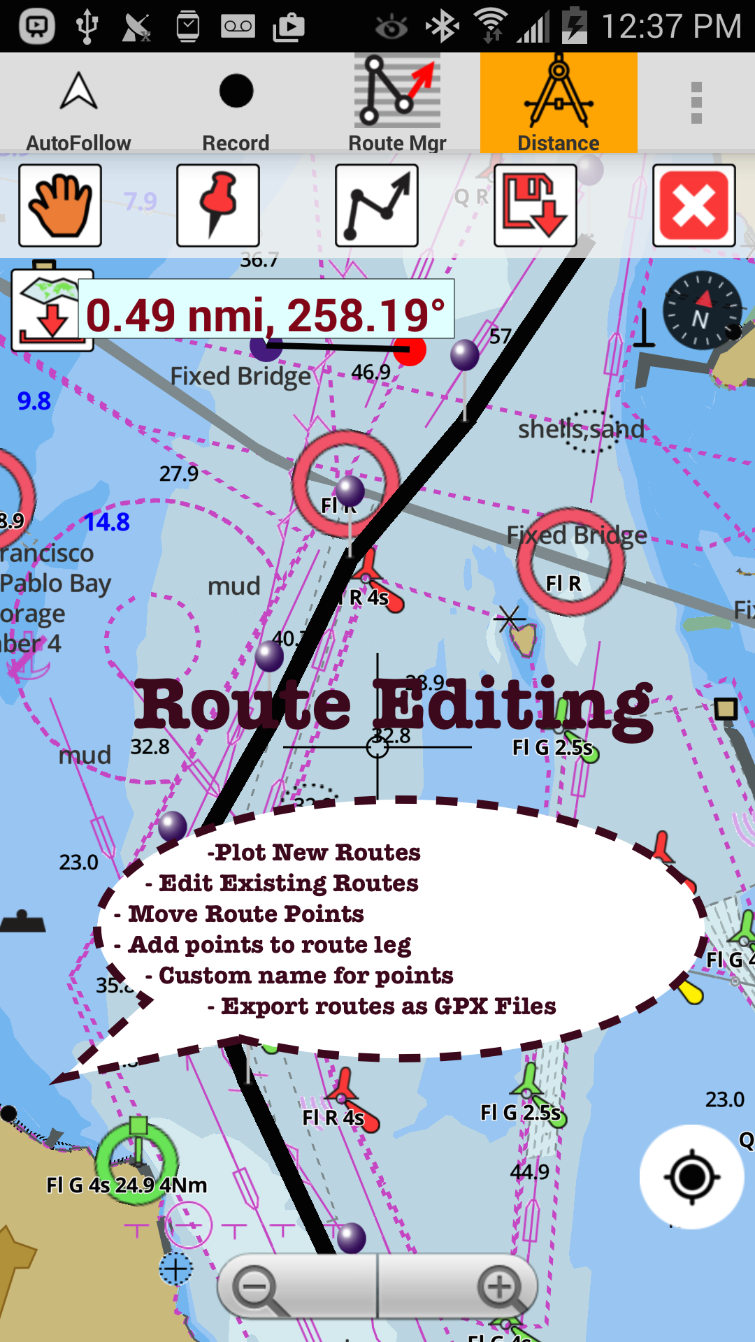
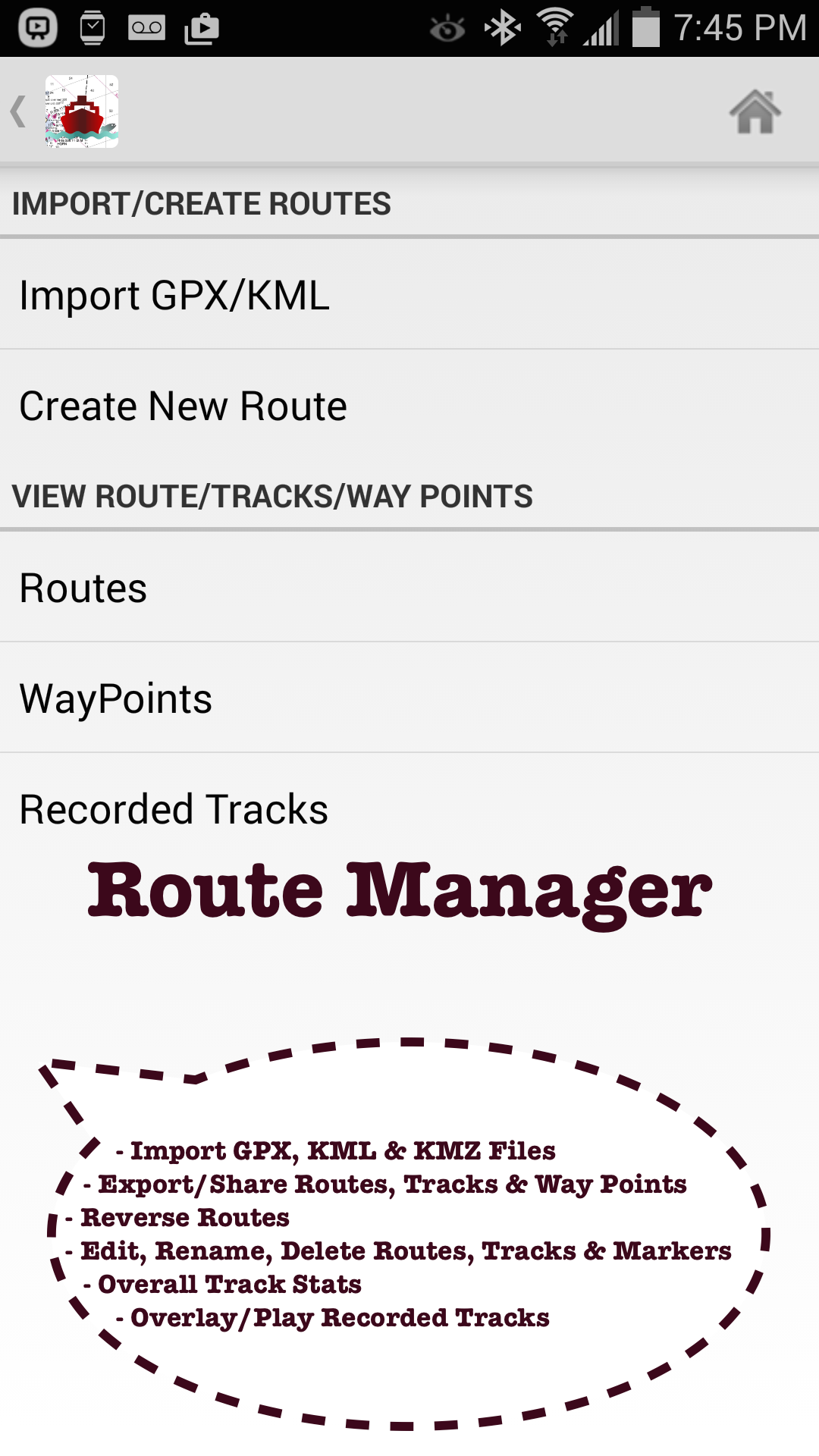
Marine Navigation / Charts App offers access to NOAA, USACE ENC nautical charts, lake depth maps & inland river navigation charts. Boating GPS app includes Marine Charts with course up orientation, marine weather data (Tide & Currents). Create new boating GPS routes /Fishing Spots or import existing GPX/KML routes. Only marine chartplotter app to have route assistance with Voice Prompts for marine navigation.►FEATURES√ Offline vector marine charts (text stays upright on rotation)√ Query details of Maritime Aids to Boat Navigation (Buoy,Lights,Obstruction,Marina etc)√ Custom depth shading of safety depth & units(Ft/Fathom/Meter/km/mi/NM)√ Record marine GPS tracks,Autofollow with real-time track overlay√ Voice Prompts for marine navigation (needs GPS )√ 1ft / 3ft depth contour maps for anglers for selected lake maps.Useful for fishing/trolling(freshwater/saltwater).√ GPX/KML for boat GPS route mgt.√ Tide & Currents.√ Seamless marine chart quilting: Map details from Coastal,Approaches,Harbour,Inland Encs(rivers)& general ENC (Electronic Marine Charts) √ Waypoints support.►FreshWater Fishing Lake maps: - Lake depth charts,boat ramps,HD depth contour maps,fishing hot spots,fish attractor locations,add fishing spots.►Instrumentation√ Marine AIS & (NMEA AIS & GPS over TCP/UDP)√ Wind direction & Speed,Sonar depth,Water temperature►Boat Navigation Voice Alerts -Alerts when sailing/boating off route or when boating wrong direction.Continuously distance & ETA updates with boating route marker prompts.►ROUTE MANAGEMENT / TRIP PLANNING√ Create/Edit/Reverse Boat Routes√ Waypoints mgt√ Import GPX,KML & KMZ files√ Share/Export Routes,Fishing Spots,Tracks&Markers► Tide & Currents -High / Low tides,Tidal Currents,Active currents stations.►Custom Background Map√ Satellite imagery,street maps,topo maps & more►GPS FEATURES for BOAT NAVIGATION√ Auto Follow*Real Time Overlay & Predicted Path Vector*Course Up*Speed & Heading (SOG & COG)►NOAA Charts for Marine Navigation√ Florida Marine Navigation ChartsCHARLOTTE HARBOR TO TAMPA BAY, KEY WESTMIAMI, EVERGLADES HARBOR√ Maryland Nautical Charts√ Virgina Marine Charts√ California Lakes & Marine ChartsSAN FRANCISCO BAY TO ANTIOCH COYOTE PT HARBORCATALINA HARBORSAN DIEGO BAYLake Tahoe√ Washington Marine ChartsSEATTLE HARBOR ELLIOTT BAY AND DUWAMISH WATERWAYTACOMA HARBORSNAKE RIVER LAKE BRYANPUGET SOUND√ Texas Marine ChartsDRUM BAY TO GALVESTON BAYGULF OF MEXICOMISSISSIPPI RIVER TO GALVESTONCORPUS CRISTI BAY PORT ARANSAS TO PORT INGLESIDE√ Louisiana Marine Charts√ Hawaii sailing chartsISLAND OF OAHUHONOLULU HARBORISLAND OF KAUAI√ Alaska FishingBERING STRAIT NORTHYAKUTAT HARBOR√ Great Lakes: Lake Michigan,Huron,Ontario,Superior,Erie√ Michigan Marine ChartsDETROIT RIVERLAKE SAINT CLAIR√ Illinois Marine ChartsCHICAGO HARBORFox Chain O Lakes√ Wisconsin Marine ChartsLAKE WINNEBAGO AND FOX RIVERMILWAUKEE HARBOR WISCONSINLake KentuckyMark Twain,Ozarks,Table Rock►Minnesota lakes: Red lake,Kabetogama,Minnetonka,Waconia,Leech,Mille Lacs►Texas Fishing : Lake Texoma,Eufaula,Toledo Bend►Florida Fishing: Lake Okeechobee,Kissimmee►Massachussets lakes Quabbin► Ohio Fishing maps of Lake hoover►Wisconsin Fishing: Lake Winnebago,Pepin► Utah Lake Powell,Bear► Maine Lake Sebago► Alaska Fishing: Lake Winnipesaukee►Tennessee Lake Barkley,Norris,Watts Bar►South Carolina Lake Keowee,Hartwell,Murray,Jocassee,Greenwood,- Satellite imagery, street maps & topos as baseman-Advanced NMEA Instrumentation- AIS over TCP/UDP- Wind Direction, Wind Speed, GPS Temperature, Sonar Depth over NMEA- Real time track overlay- Voice prompts for marine navigation- Nautical Charts Course up- Route Manager- Tide & Currents- Option to keep screen on during navigation- Display Boats speed- Inland rivers data published by USACE-Minnesota lakes HD(1ft)- Kabetogama, Minnetonka, Waconia,Leech,Mille Lacs etc.