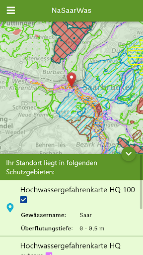
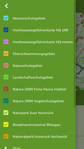
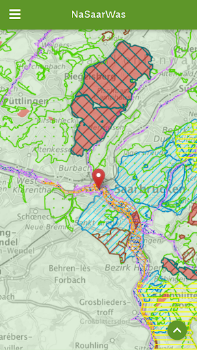
The mobile protected area assistant from the Saarland Ministry for the Environment, Climate, Mobility, Agriculture and Consumer Protection.Dont want to spend a lot of time researching whether your project is in a protected area?With the free app from the Ministry for the Environment, Climate, Mobility, Agriculture and Consumer Protection, you as a tradesman, specialist company, builder, homeowner, planner or citizen can find out at any time and in seconds whether your project is in an area with special requirements Nature conservation/flood/groundwater apply.Whether professional or private, the app provides you with valuable initial information about your location and uses the official data from the Saarland Geoportal of the LVGL (State Office for Surveying, Geoinformation and Land Development).No registration required - get started straight away!“NaSaarWas”: know across Saarland whether your project is in a protected areaNature conservation NaFlood Saar (representing the surface waters of the Saarland) orGroundwater What lies.Do you want information?Demand: “Well, say something!” (Saarland) / Translation: “Well, say something!” (High German)Source note for map material:© Federal Office of Cartography and Geodesy 2020, data sources: http://sg.geodatenzentrum.de/web_public/Datenquelle_TopPlus_Open.pdf