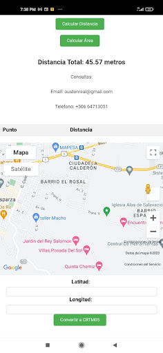
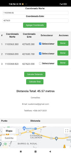
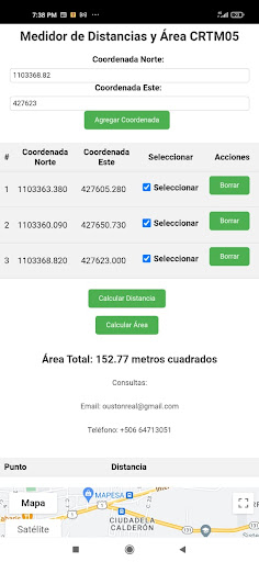
Costa Rica Measurements is an innovative application designed for professionals and enthusiasts of surveying, cartography and geodesy. With functions similar to those of AutoCAD, our application allows you to move points online by coordinates with degrees, facilitating the manipulation and analysis of geospatial data.Main features:Online Point Offset: Easily adjust the coordinates of your points using degrees, just as you would in AutoCAD, improving the accuracy of your calculations and analysis.Distance Measurement: Quickly calculate the distances between two points on your coordinate table, allowing you to analyze and plan more efficiently.Calculation of areas: Determine the area of polygons formed by the points in your table, giving you a useful tool for land planning and decision making.WGS84 Coordinate Conversion: Convert your coordinates between different reference systems, including the popular WGS84, ensuring compatibility and accuracy in your geospatial projects.Measurements Costa Rica is an essential tool for engineers, surveyors, cartographers and anyone interested in the management and analysis of geospatial data. Download Mediciones Costa Rica today and take your projects to the next level.WEBSITE: ESPARZARTK.COM