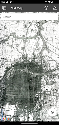
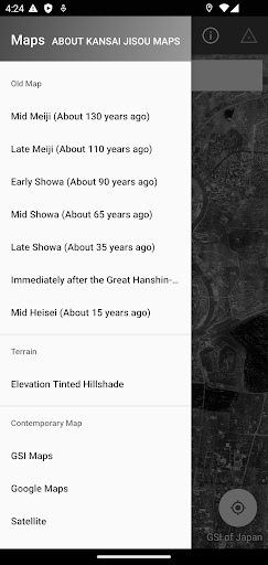
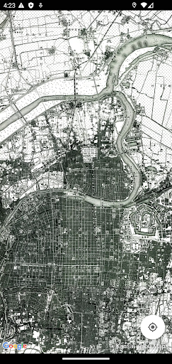
The "Kansai Jisou Maps" is a map application that allows you to learn about the changes in the Kansai region centering on Kyoto, Osaka, Kobe and Nara, based on the time axis from the Meiji era to the present day. With its long history, this region has prospered as the center of Japan since ancient times and continues to be an important region of Japan.From the Meiji era (1868-1912), when modern surveying began with the opening of civilization, to the Taisho and Showa eras, through the Heisei era (1912-1989), and up to the present day, we have captured many maps that have been continuously produced in a small smartphone that fits in the palm of your hand. The "Kansai Jisou Maps" allows you to know the origins of the land in three dimensions by using the GPS function and the "time-layer" that overlaps multiple eras. Enjoy time travel with your smartphone!----------Map Types----------Old Map·Mid Meiji 1884-1898·Late Meiji 1908-1910·Early Showa 1922-1938·Mid Showa 1947-1964·Late Showa 1985-1989·Immediately after the Great Hanshin-Awaji Earthquake 1995·Mid Heisei 2000-2008Terrain·Elevation Tinted Hillshade·GSI Maps...and Contemporary Maps, Old Aerial Photographs----------Coverage of old maps----------Coverage of Kansai Jisou Maps (Japan Map Center website)https://info.jmc.or.jp/jisoumaps/kansai/boundary/----------Caution----------·An Internet connection is required to view the map.·The use of the recorded maps is subject to procedures based on laws and regulations.·The accuracy of the location of the map is not guaranteed. Please treat it as reference information.·The user shall be fully responsible for any and all damages incurred by the user in connection with the use of this application for any reason whatsoever, and Japan Map Center shall bear no responsibility whatsoever.·The old maps included in this application may contain expressions that are considered inappropriate today, but they are included as they are as historical documents that show the era in which the maps were created. Please use with understanding.