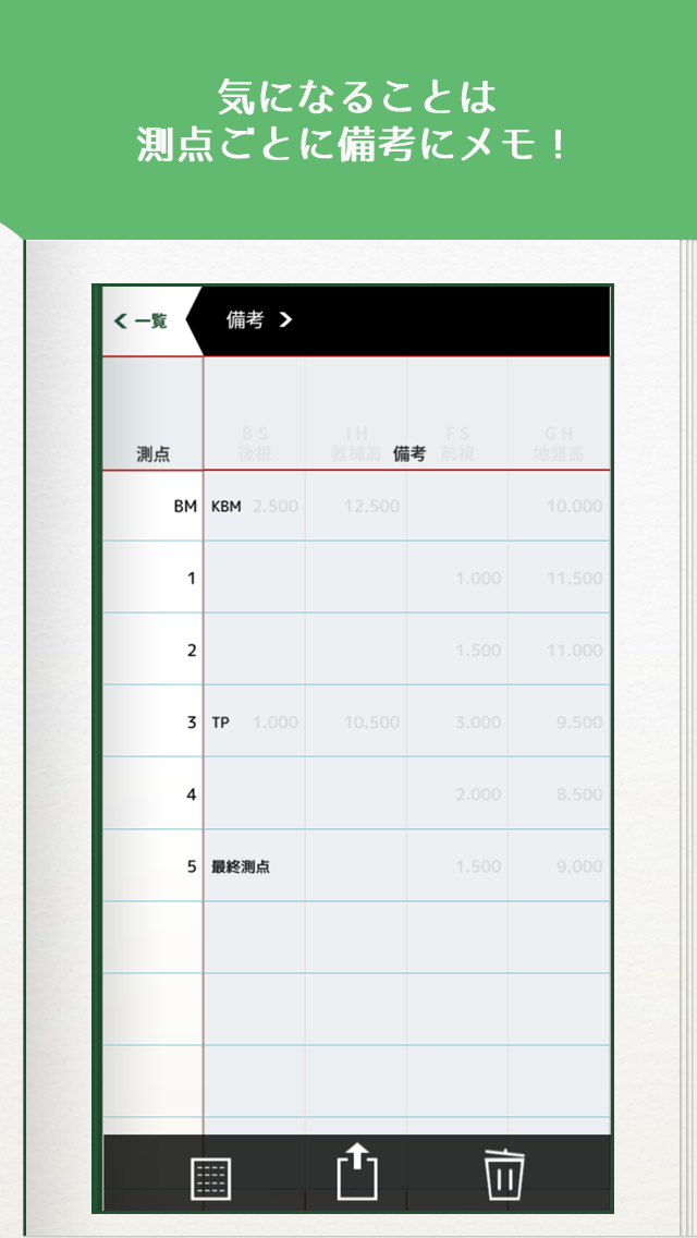
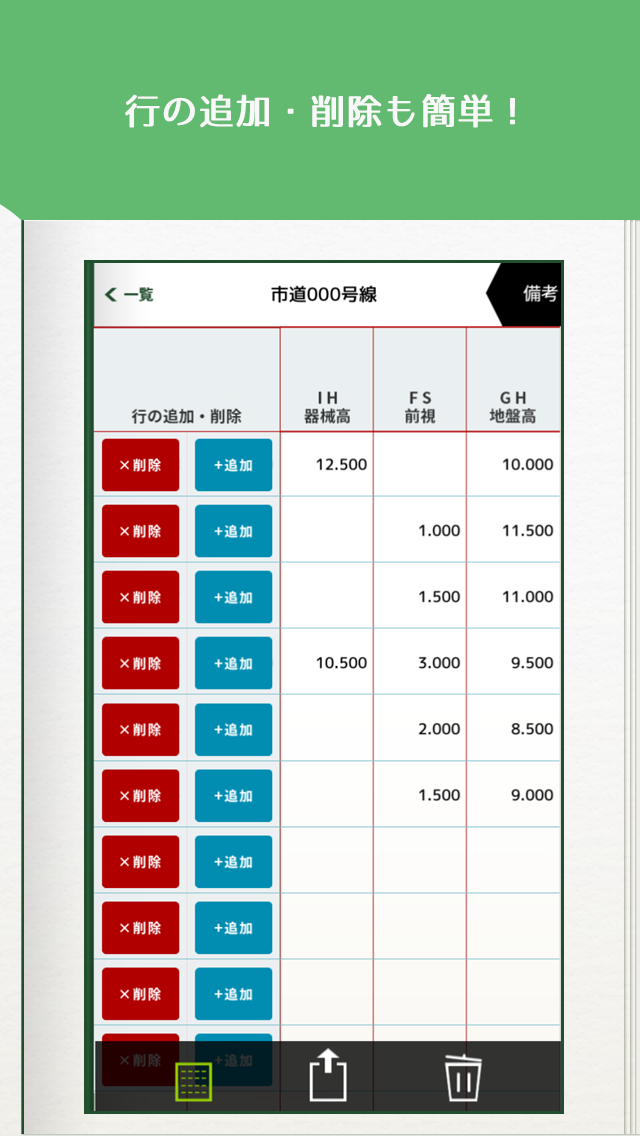
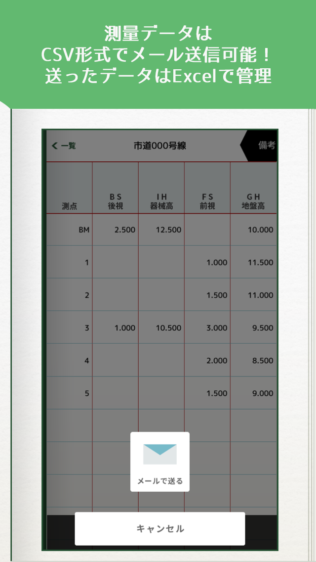
「測量野帳」は現場で簡単に使える水準測量専用の野帳アプリです。※Version2 からご要望の多かった計画高を導入しました。 「ここを自動で計算してくれたら楽なのに」「測量結果をデータで残したい」「野帳をデジタルで管理したい」「測量の時間を短縮したい」「丁張の情報を今すぐ確認したい」 そんな望みを叶える為の測量アプリを作りました。現場代理人や現場監督、測量士の方に役立てて頂けると幸いです。※使い方をアップしました。http://youtu.be/XJLxjYfnL40■□■□■□■□ 機能と特徴と意気込み □■□■□■□■# 野帳入力方式は器高式# 現場ごとに測量データを管理# 地盤高と後視を入力すると、器械高が自動計算# 器械高が入力された状態で前視を入力すると、地盤高が自動計算# 地盤高と計画高の自動計算# 丁張用に、計画高からの天端高を入力# 測量データはcsv形式でメール送信# 測点ごとに備考入力# 行の追加・削除# 行追加・削除時のハイライト機能# 行削除時に測点名表示# 設定ページ(文字大きさ設定)### あれ実装して!とレビューにご意見・ご感想いただければ対応がんばります!### 些細な要望でもご連絡ください!### 応援レビューで開発者はやる気がUPします!■□■□■□■□ 今後の予定 □■□■□■□■# 値変更時の全体自動計算# 測点の連番入力"Surveying field book" is a field book application of leveling dedicated that can be used easily in the field.※ we introduced a lot was planning sales of requests from Version2."Even though easier After me calculated automatically here.""I want to leave the survey results in the data.""I want to manage a field book in digital""I want to shorten the time of the survey.""I want to check the information of Zhang Zhang now".We made a survey application for grant such a wish.Site agent and field coach, we are happy if you could to help those of surveyors.※ I was up how to use it.http://youtu.be/XJLxjYfnL40■ □ ■ □ ■ □ ■ □ functions and features and enthusiasm □ ■ □ ■ □ ■ □ ■# Field note input method vessel high formula# Manage survey data for each site# If you enter a ground elevation and a rear view, instrument height is automatically calculated# If you enter a pre-view in a state in which the instrument height is entered, the ground height is automatically calculated# Automatic calculation of ground elevation and plan high# For Zhang Zhang, type the crest height from planning high# Surveying data is e-mail sent in csv format# Each and measurement point to the remarks input# Add or delete rows# Highlight function when added or deleted rows# The stations name display at the time of the row deletion# Settings page (letter size setting)### By any implementation! If you Feedback to review and well try correspondence!### Please contact us even a trivial request!### Cheering review on developers motivation will be UP!■ □ ■ □ ■ □ ■ □ Future Plans □ ■ □ ■ □ ■ □ ■The entire automatic calculation of the time # value changeSerial number input of # stations# 計画高の追加# 地盤高と計画高の差分を自動計算# 丁張用に、計画高からの天端高を追加# 行削除時に測点名表示# 器械高の入力を禁止# レイアウト調整# 不具合修正