
Estimation application downloads and cost
Description
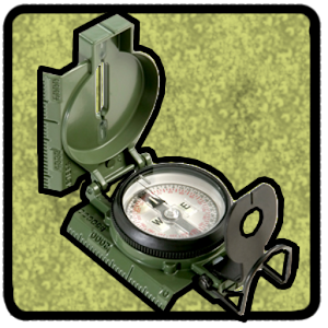
Land Nav Assistant accepts MGRS (Military Grid) or Latitude / Longitude coordinates and visually navigates you to each point. This app was designed with Army, Marine, and other military personnel in mind. Use it to correct your Land Nav technique by analyzing your pace count and tendency to veer left and right.
Available Input: 8/10 digit MGRS, latitude/longitude, and map input.
Simple arrow interface directs you to your point. In addition, your distance, direction, speed, and bearing are shown as you navigate.
Satellite map view shows all your points, and let you add new ones.
Displays distance/direction from your currently location to all points.
Export your list of points to a spreadsheet for personal use.
Import or share your points via spreadsheet. You don't have to enter points with your device keyboard anymore! The import utility is available at: https://www.gammonapplications.com/landnavimport/
This app uses the Military Grid Reference System (MGRS) and Latitude / Longitude. It utilizes the WGS84 datum for calculations.
Choose to display your MGRS locations as 10-digit or 8-digit.
Angles can be displayed in degrees or mils.
D:M:S can be input in the format DD:MM:SS followed by the appropriate direction (NSWE). Default direction is N, W.
Examples of valid DMS Inputs: 40:43:0 , 74:0:040:43:00N , 74:0:0W40:43:00N ,-74:0:0E
DO NOT use this application while learning Land Navigation. Land Navigation is a valuable skill, and should be mastered before using this application. Do not rely solely on this application for navigation, especially when lost. Always be aware of your surroundings.
Read more
Available Input: 8/10 digit MGRS, latitude/longitude, and map input.
Simple arrow interface directs you to your point. In addition, your distance, direction, speed, and bearing are shown as you navigate.
Satellite map view shows all your points, and let you add new ones.
Displays distance/direction from your currently location to all points.
Export your list of points to a spreadsheet for personal use.
Import or share your points via spreadsheet. You don't have to enter points with your device keyboard anymore! The import utility is available at: https://www.gammonapplications.com/landnavimport/
This app uses the Military Grid Reference System (MGRS) and Latitude / Longitude. It utilizes the WGS84 datum for calculations.
Choose to display your MGRS locations as 10-digit or 8-digit.
Angles can be displayed in degrees or mils.
D:M:S can be input in the format DD:MM:SS followed by the appropriate direction (NSWE). Default direction is N, W.
Examples of valid DMS Inputs: 40:43:0 , 74:0:040:43:00N , 74:0:0W40:43:00N ,-74:0:0E
DO NOT use this application while learning Land Navigation. Land Navigation is a valuable skill, and should be mastered before using this application. Do not rely solely on this application for navigation, especially when lost. Always be aware of your surroundings.
Land Nav Assistant screenshorts