
Stirling - Clackmannanshire Bridge.
29 milesStirling - Tillicoultry.
25 milesSatnav Cycle Routes around Stirling using cycle paths and roads.
Both routes have turn-by-turn navigation with voice instruction.
Enjoy the benefits of cycling a whole route by following Sat Nav instructions without having to buy an expensive Sat Nav.
Just download the app to your device.Using Satnav Cycle Routes means that you no longer have to use paper maps when you try new cycle routes.
Even if you take a wrong turn the app will quickly work out a new route on your device to get you back on track.
The routes are all graded to give you an idea of how easy or difficult they are.
You are also advised which type of bike the routes are suitable for, the type of terrain and the length.
The routes are not all traffic-free but use paths as much as possible together with quiet roads.
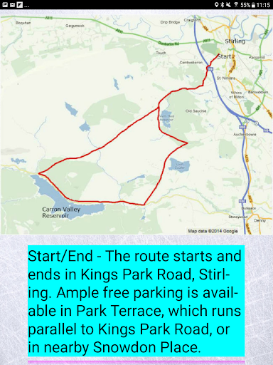
Both routes are circular and start and end at the free car park for the Sports Village in Forthside Way, Stirling.
The entrance is on the Springkerse Roundabout.
https://andro.io/app/stirling-ian
 Power 100


Android app profile
Satnav Cycle Routes – Stirling for Android – Latest Version & Features
by Ian Lochhead
★★★★★
(0 ratings)
Rate this app
How do you feel about Satnav Cycle Routes – Stirling?
Thanks for your feedback!
> 2.2k
Monthly Downloads
~$900
Estimated Cost
Screenshots


